Business & Tech
Map-Maker Sees Hudson River From a Boater’s Perspective
The Flat Iron Gallery is hosting a reception for the artists whose works are featured on the guide on April 22. The map covers from Waterford to Peekskill.


It is called “The World’s Most Complete Guide for Small Boaters to New York State’s Upper and Mid-Hudson River Estuary” and for Hudson River lovers, boaters and artists alike, this new map is a real keepsake.
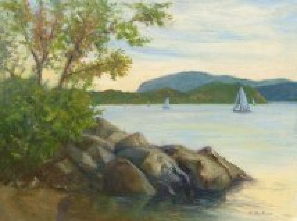
Albany-based Bill Newman has produced this unique guide that covers 120 nautical miles between Peekskill and Waterford, New York, and contains images of original art works by a number of noted Hudson Valley artists, featuring scenes painted along the river.
Wendie Garber, an artist and gallery owner in Peekskill for the past 16 years, will host a reception on April 22 at the to celebrate the release of the beautifully adorned work and to honor the artists who contributed to it. Several painters from the Mid-Hudson River Valley donated images of their original oil paintings to illustrate Newman’s map—including Anne Johann, Jessica Miller, Phyllis Tarlow and Garber herself.
Interested in local real estate?Subscribe to Patch's new newsletter to be the first to know about open houses, new listings and more.
“The way Bill Newman honors the majestic Hudson, and by incorporating these artists’ works, he has literally put Peekskill on the map,” Garber said.
Newman, an avid kayaker and boater, said it was during a trip to the San Juan Islands in the Puget Sound last year that he came across an illustrated map of the local landscape. It inspired him to create a detailed guide for the Hudson River—one designed distinctly from a boater and kayaker’s perspective. He said he wanted to use the Hudson-inspired artwork of local artists to bring vitality to the map.
Interested in local real estate?Subscribe to Patch's new newsletter to be the first to know about open houses, new listings and more.
“I was struck by the way artwork can open one’s imagination and bring a map to life,” he said.
The map, that was completed with the help of graphic designer Rick Alton, includes information on 11 marinas, 20 boating clubs, various Revolutionary War sites, kayaking tours, historic homes and gardens, local restaurants—and even walking tours for 13 riverfront communities. It will retail for $17.95 and will be available at , at the Flat Iron Gallery, at the Beacon Institute for Rivers & Estuaries Bookstore and Gallery and can also be ordered on Newman’s website.
Garber said the reception, which takes place on April 22, Earth Day, from 1-3 p.m. at the Flat Iron Gallery, will welcome politicians like Peekskill Mayor Mary E. Foster, community members, Hudson River conservationists and environmentalists, art lovers, as well as the general public.
“We will give away the first 100 maps, and proceeds will be donated to the Community Boat Works organization of Peekskill, which teaches disadvantaged youth teamwork and technical skills by building wooden kayaks,” Newman said.
As for the city of Peekskill, the map-maker said he is impressed with the overwhelming generosity of this art-centered city on the Hudson.
“I really came to love this special city when I participated in the Dragon Boat Race during the Peekskill Celebration,” he said.
And then he spoke of his reverence for the river.
“Those of us who are fortunate enough to live and play along the Hudson must continue to make it a clear and more accessible river.”